Documents & Sources
Read the full proposal and check every source
Planning phase. An independent plan; nothing is funded or built yet. What this means
Documents
Start here, in this order
The short summary first, then the longer summary and the two-page summary, then the one-page map.
1. Short summary (v1.1)
Plain text · 3 sentences
The plan in three sentences: what it is, its two phases, and its honest status.
2. Longer summary (v1.2)
Plain text · about 250 words
The plan in about 250 words, ready to paste into an email or newsletter: what it is, Phase 1 and Phase 2, the conditional dates and the next step.
3. Two-page summary (v1.2)
PDF · 2 pages · letter · about 1,000 words
The plan on two pages: Phase 1 with its options and extensions, the Phase 2 corridor options past Bethlehem, the conditional dates, long-term ideas, what has not been done and what is being asked.
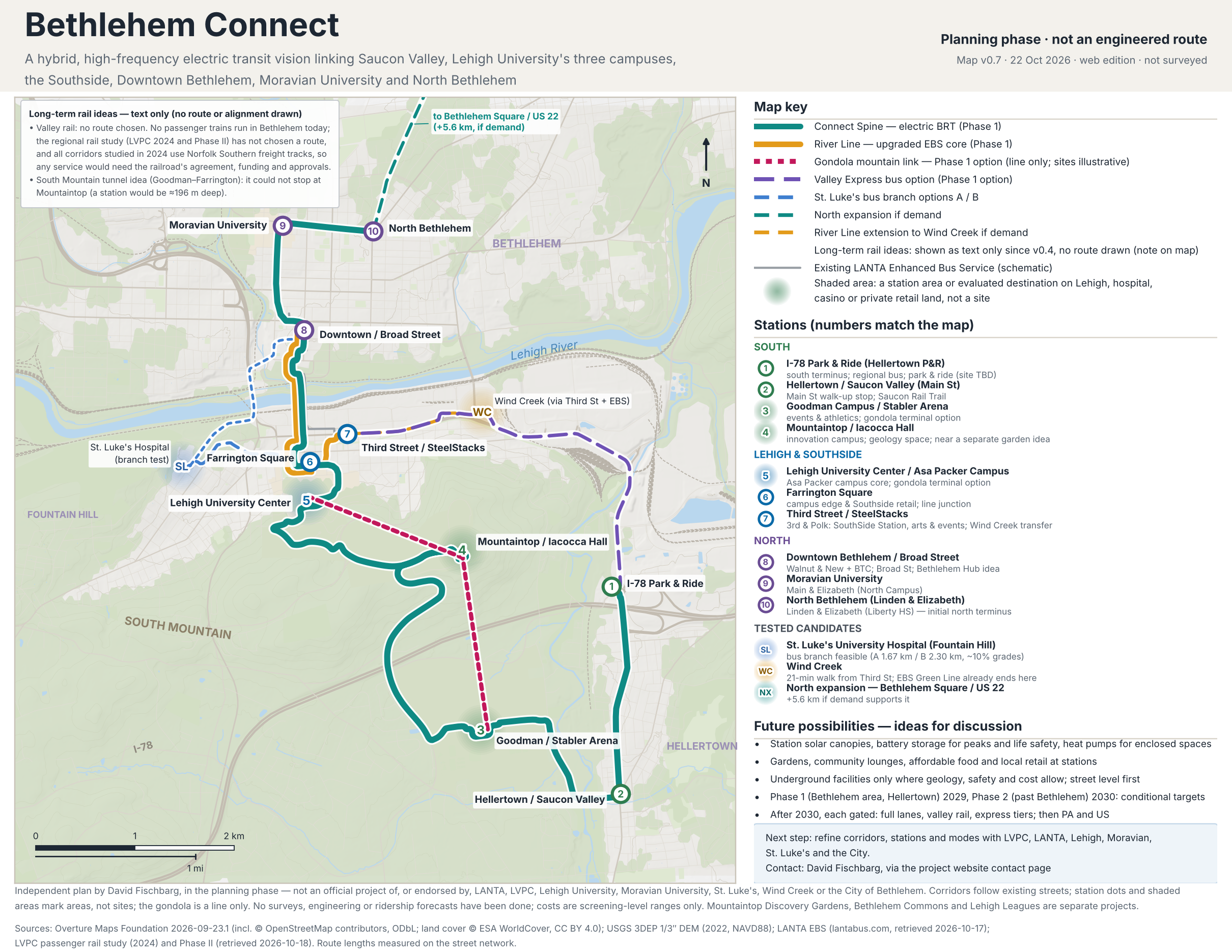
4. One-page map (v0.7)
PDF · 1 page · letter landscape
The whole proposal on one page: map, stations, phases and status.
Download PDF (0.9 MB): One-page map (v0.7)PNG image (2.3 MB): One-page map (v0.7)
More documents
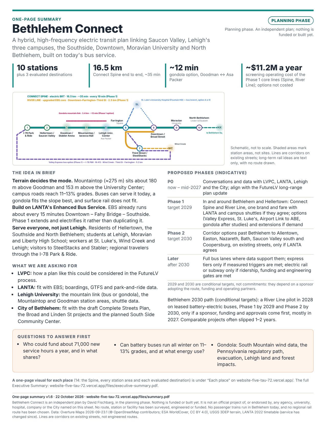
One-page summary (v1.6)
PDF · 1 page · letter
The plan on one printable page: the idea, headline numbers, indicative phases, what is being asked and the questions to answer first.
Download PDF (0.3 MB): One-page summary (v1.6)JPEG image (0.4 MB): One-page summary (v1.6)
Executive Summary (v1.6)
PDF · 3 pages · letter
The idea in brief, phases, modes, findings, costs, the Bethlehem 2030 path and open questions.
Long-Term Vision Supplement (v1.6)
PDF · 6 pages · 11×17 landscape
One philosophy across separate projects; design rules; reuse it anywhere; the author's aim of natural energy only; express and multi-track planning; town, city and park links; league-day transit; Dig & Discover.
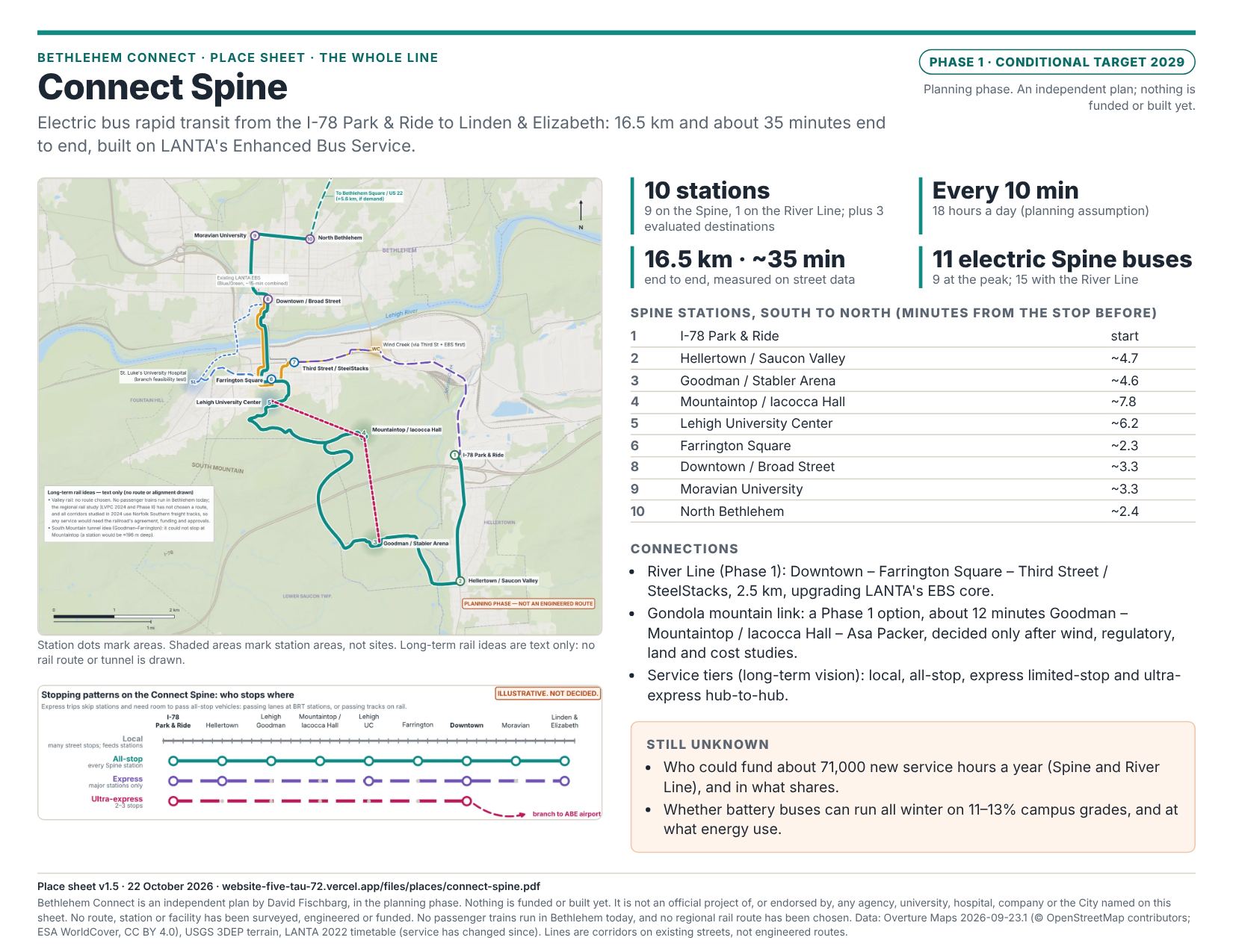
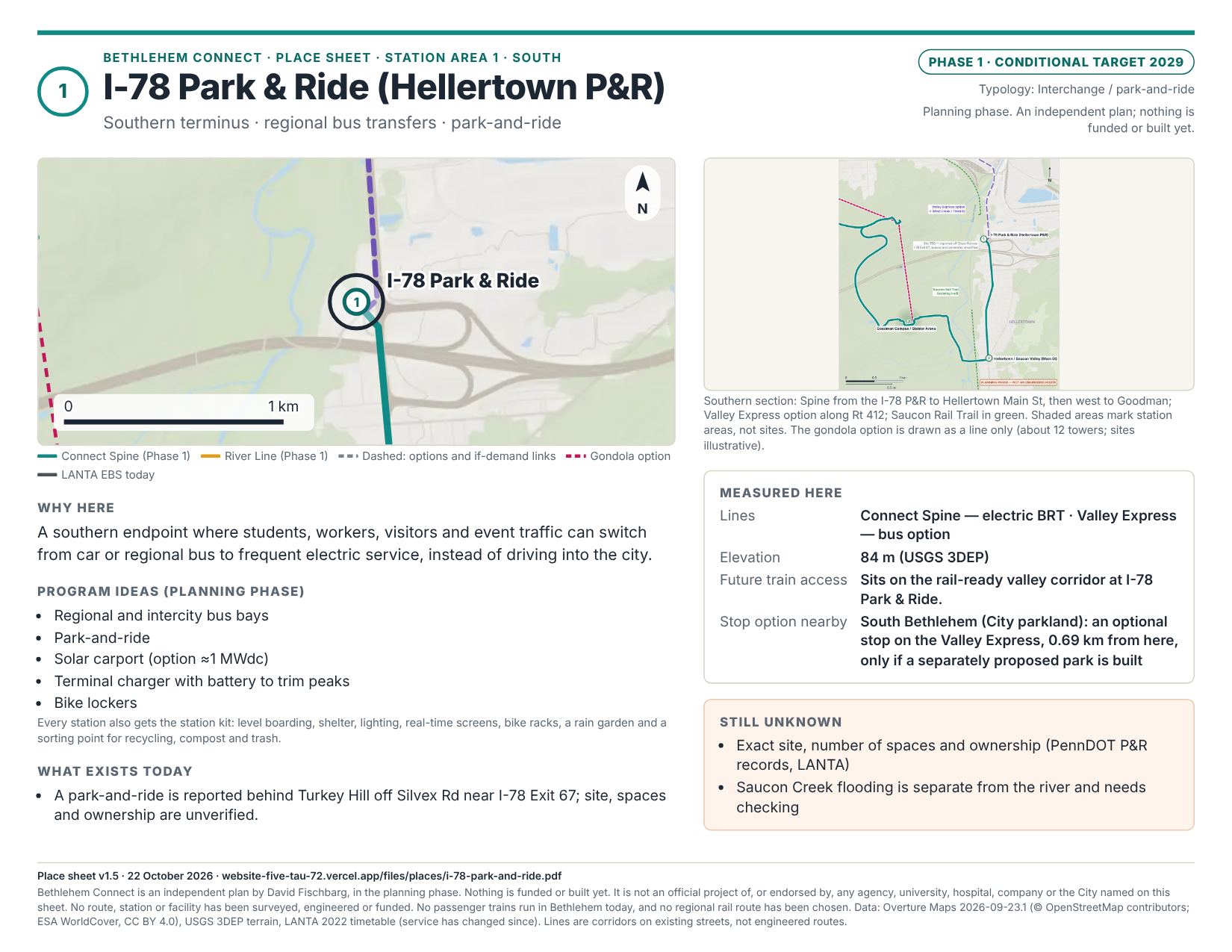
Place sheets: one page for each place
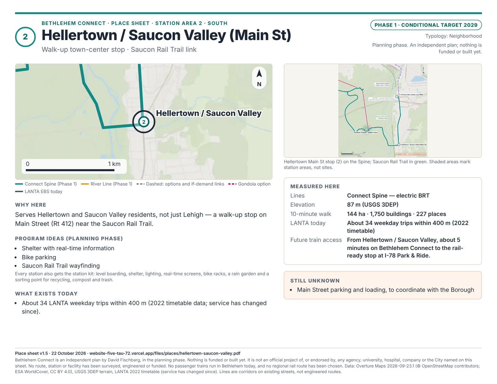
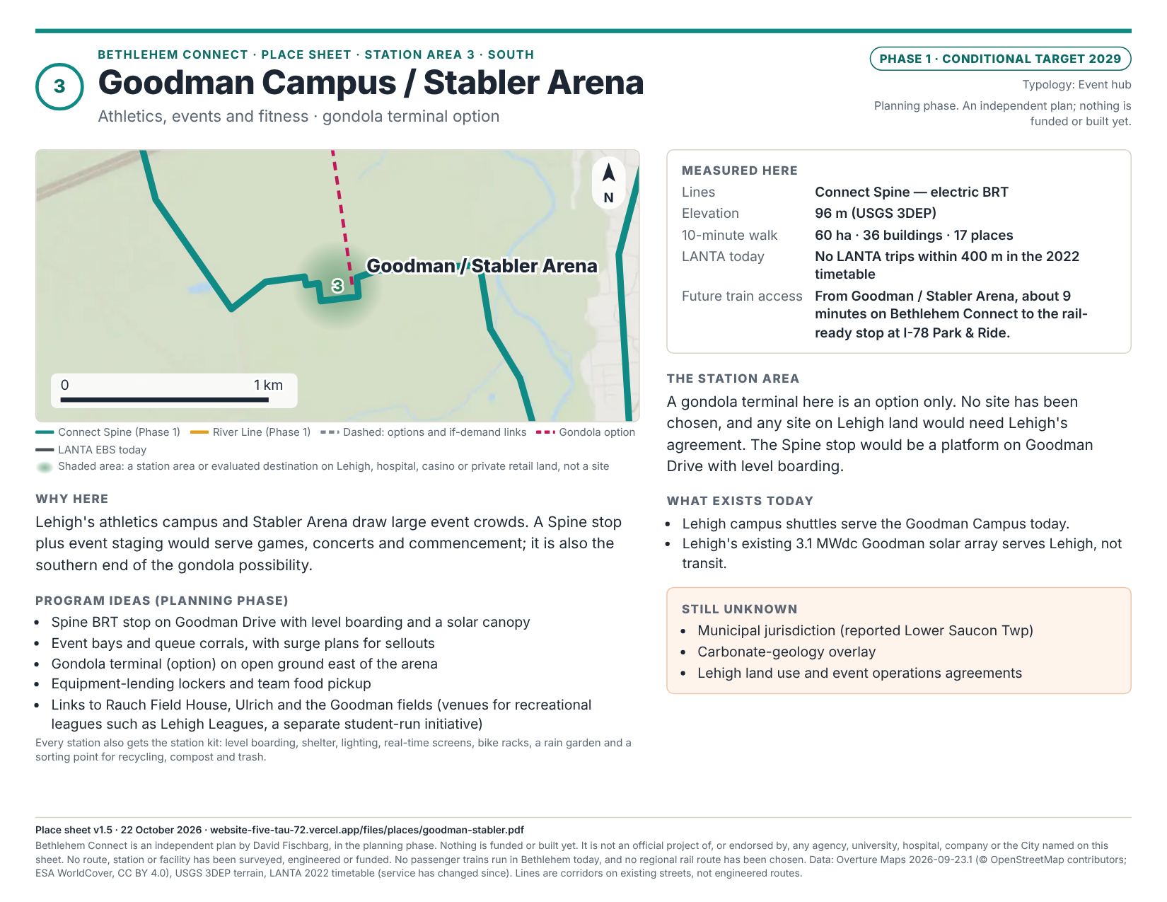
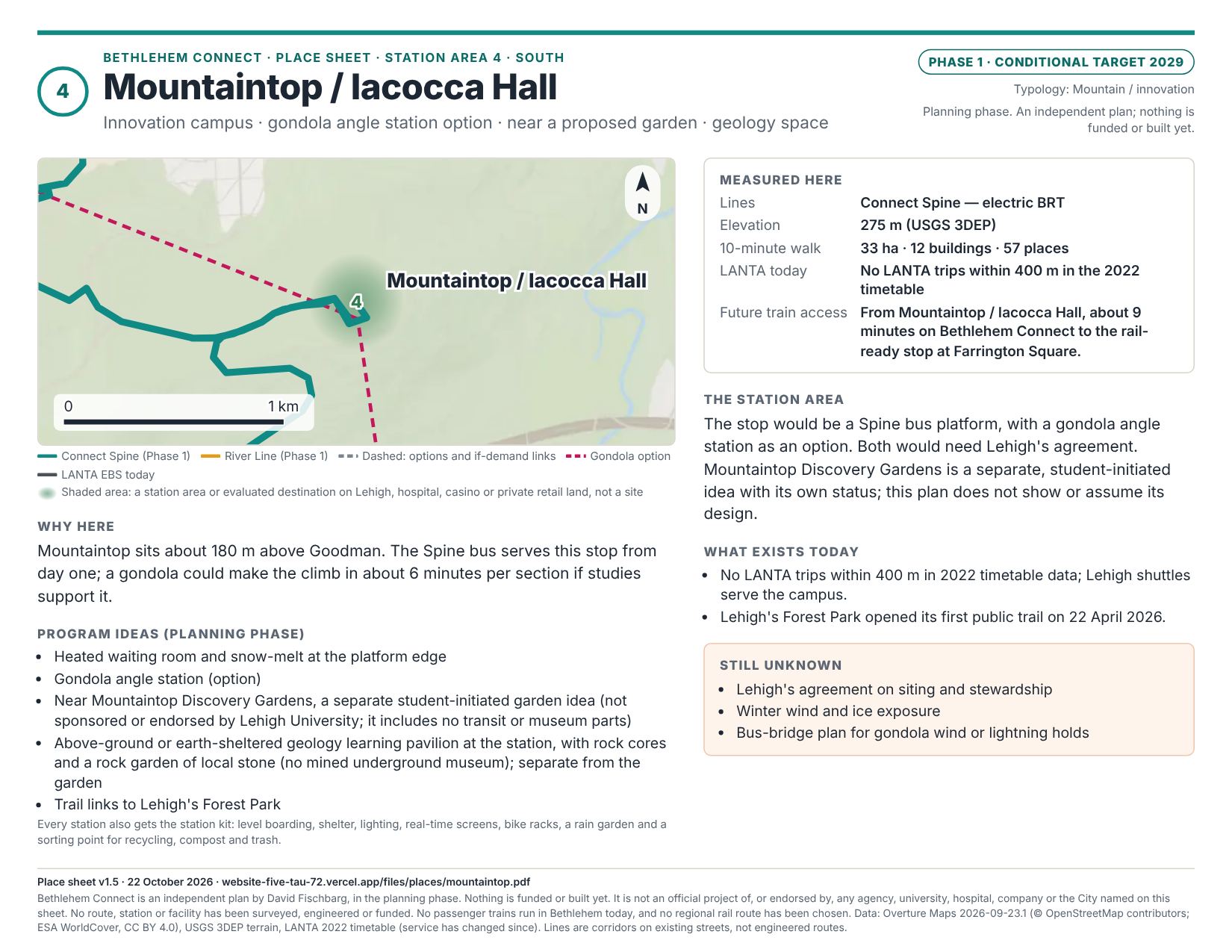
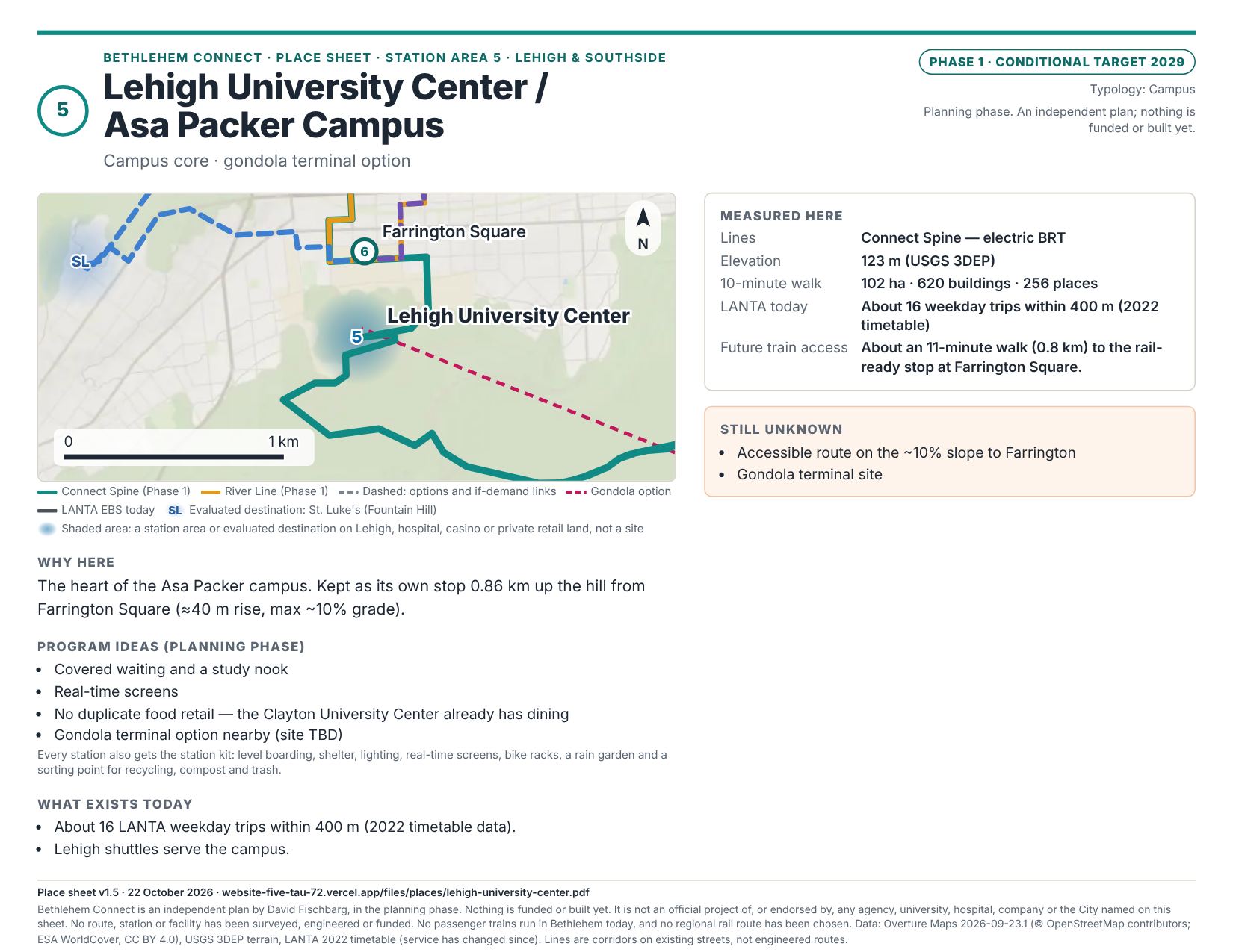
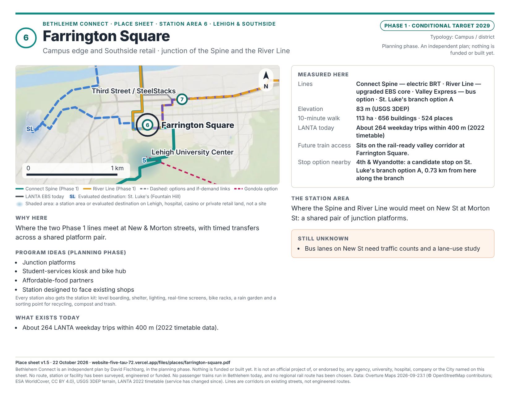
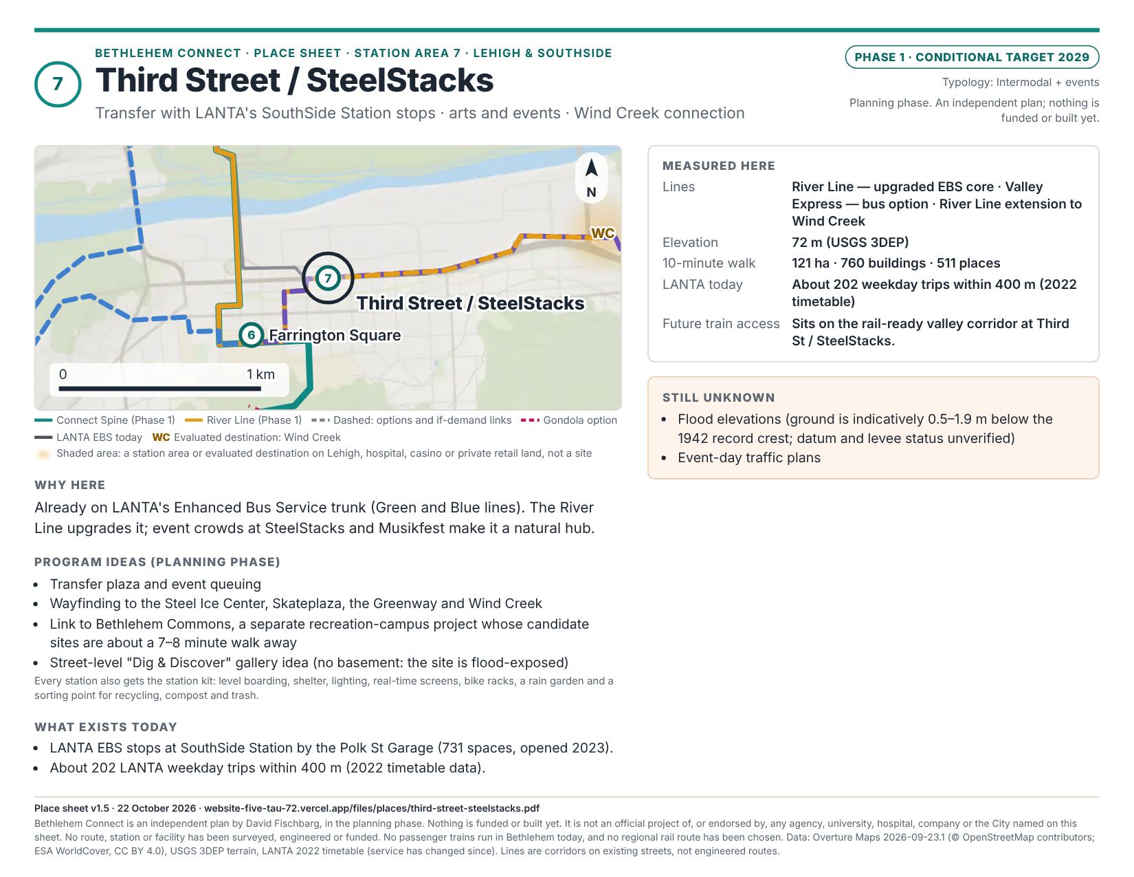
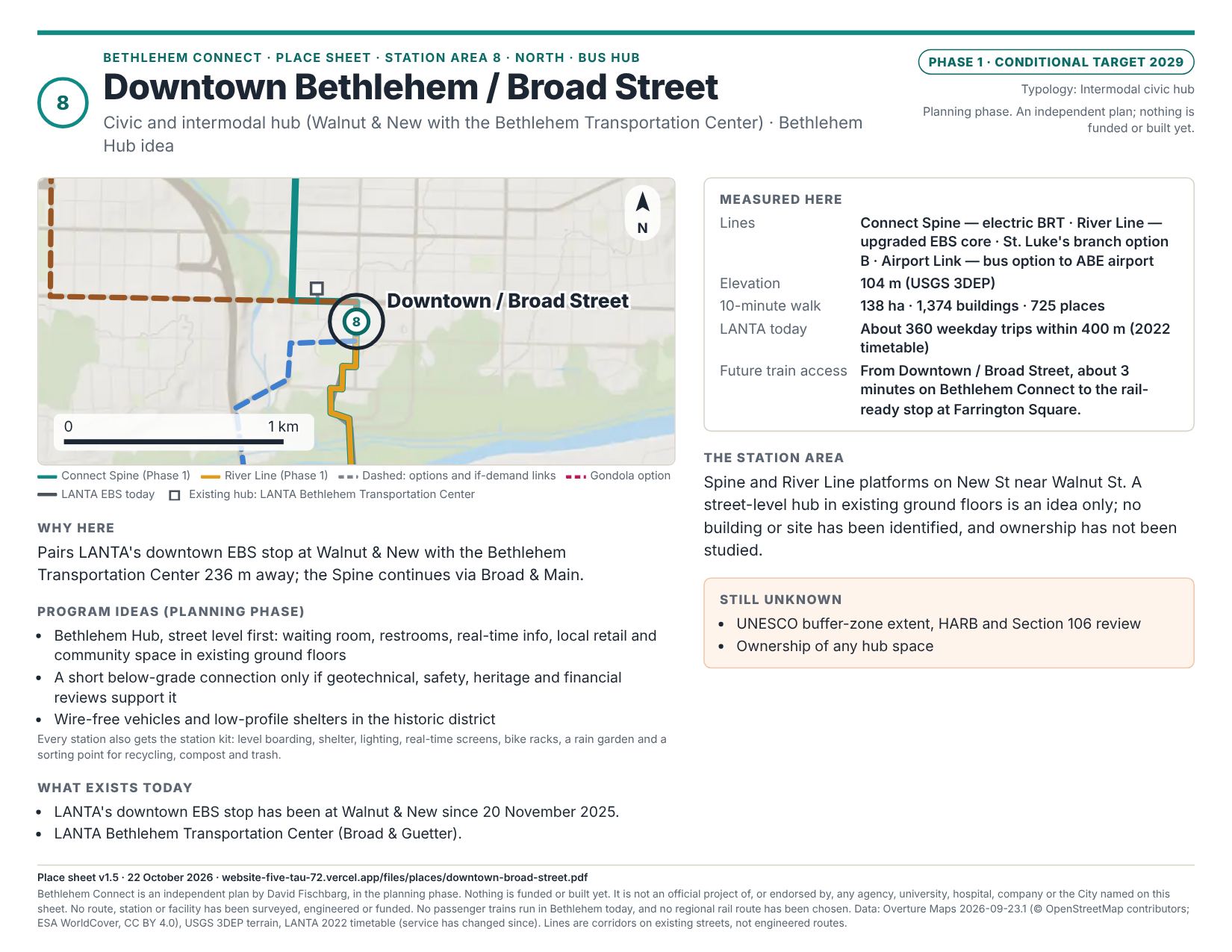
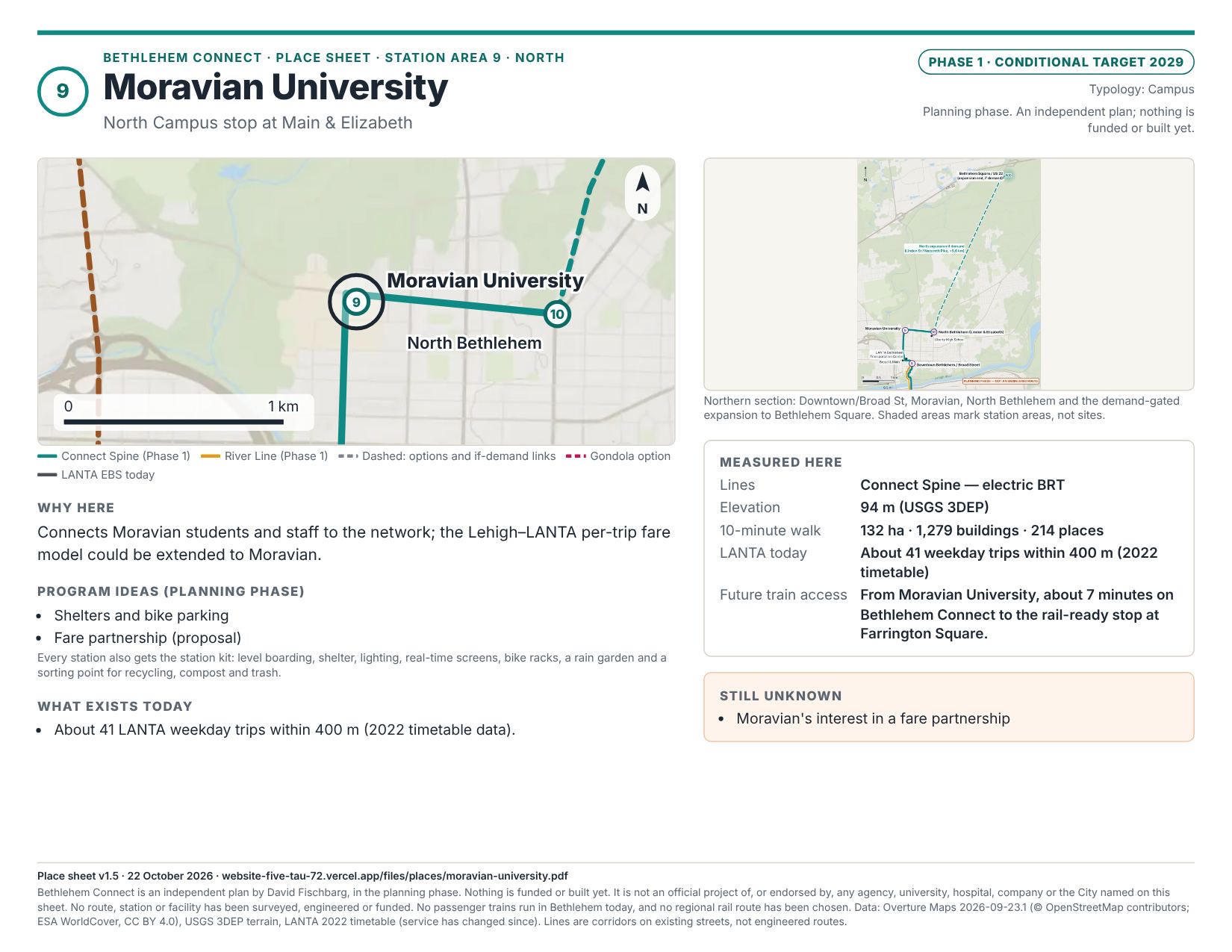
The whole line and every station area or evaluated destination on one letter page each: picture, locator map, measured facts, ideas and open questions. Each has a page on this site, a PDF and an image.
- Connect Spine
- 1 · I-78 Park & Ride (Hellertown P&R)
- 2 · Hellertown / Saucon Valley (Main St)
- 3 · Goodman Campus / Stabler Arena
- 4 · Mountaintop / Iacocca Hall
- 5 · Lehigh University Center / Asa Packer Campus
- 6 · Farrington Square
- 7 · Third Street / SteelStacks
- 8 · Downtown Bethlehem / Broad Street
- 9 · Moravian University
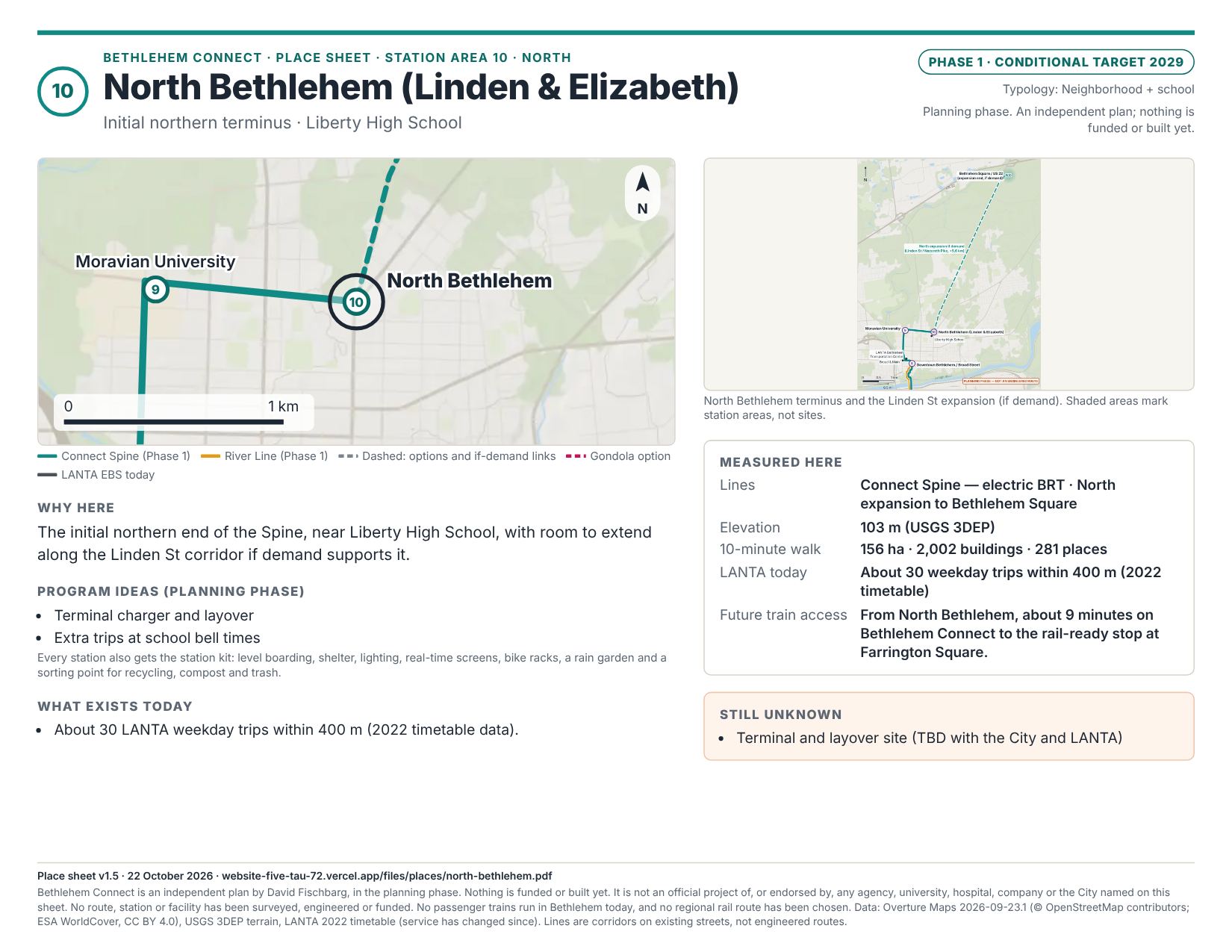
- 10 · North Bethlehem (Linden & Elizabeth)
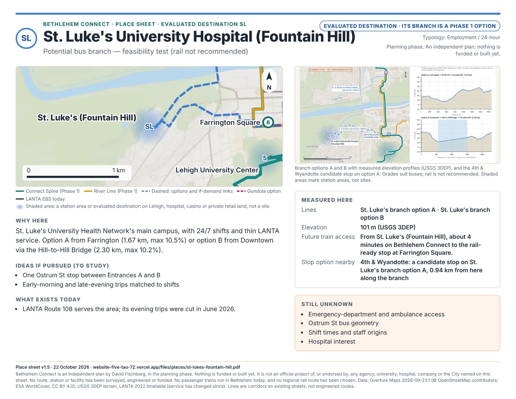
- SL · St. Luke's University Hospital (Fountain Hill)
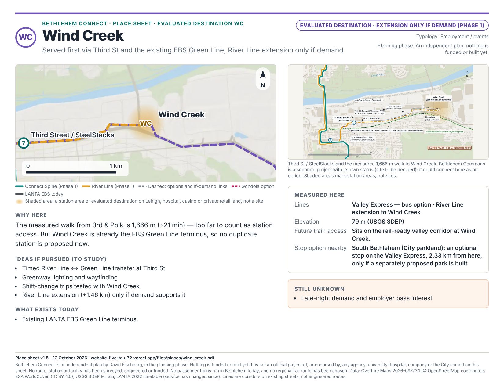
- WC · Wind Creek
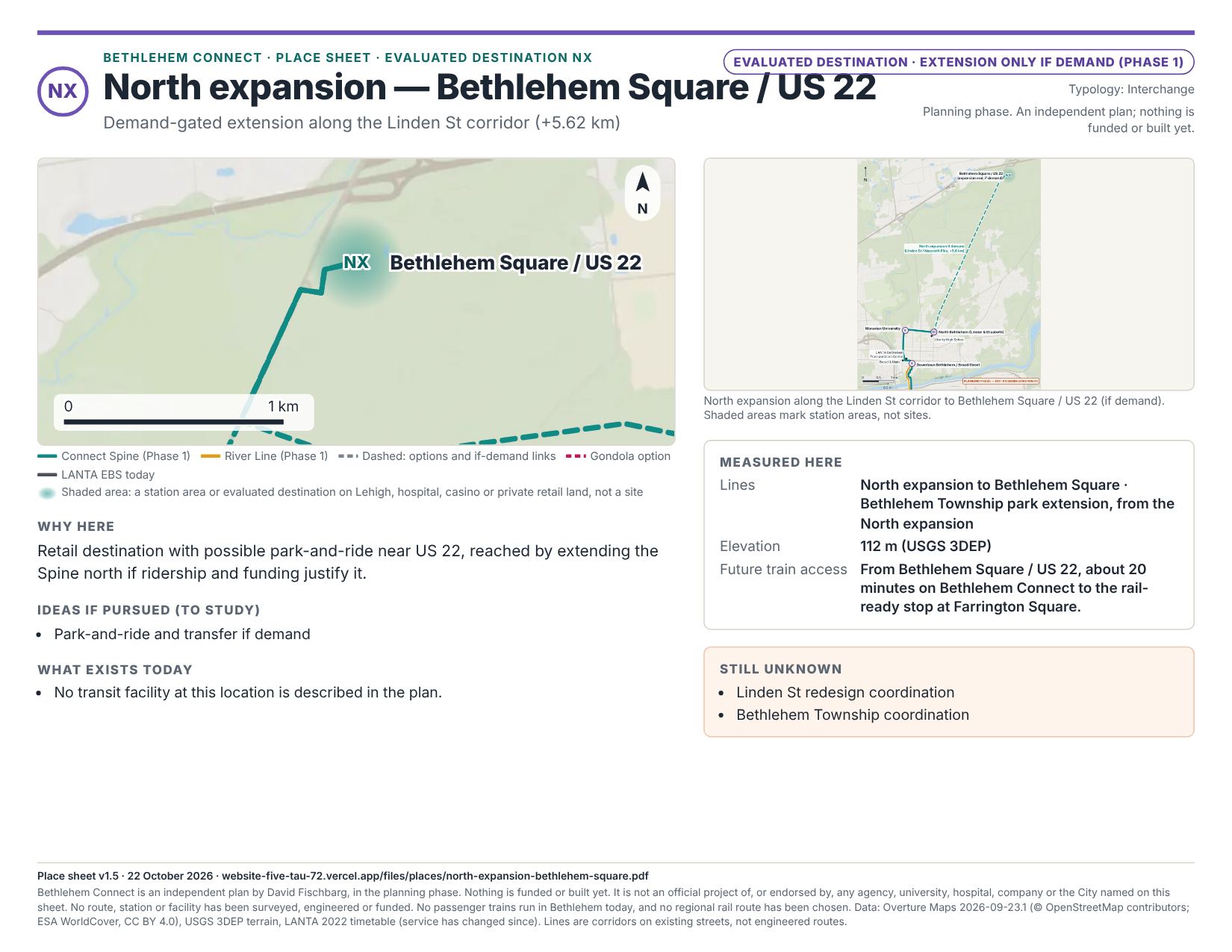
- NX · North expansion — Bethlehem Square / US 22
Version and status
Data credits
- Data
- Streets, buildings, land use and cover, water, boundaries, places
- Source
- Overture Maps Foundation release 2026-09-23.1
- License / note
- Transportation, land use, water and divisions: ODbL (© OpenStreetMap contributors, Overture Maps Foundation). Buildings: ODbL (OpenStreetMap, Microsoft ML Buildings) and Esri Community Maps (CC BY 4.0); some heights from USGS lidar (public domain). Land cover: © ESA WorldCover project, contains modified Copernicus Sentinel data processed by the ESA WorldCover consortium (CC BY 4.0). Places: CDLA-Permissive-2.0 (some Foursquare records Apache-2.0).
- Data
- Terrain, hillshade, grades, elevations
- Source
- USGS 3D Elevation Program, 1/3 arc-second DEM tile n41w076 (published 2022-11-15; lidar 2017–18; NAVD88)
- License / note
- Public domain
- Data
- Existing transit (schematic)
- Source
- LANTA public pages: Enhanced Bus Service, schedules (2025-12-04), Walnut & New stop (2025-11-20), fares and service changes (2025–26)
- License / note
- Schematic only — see lantabus.com for official routes
- Data
- Transit stop activity (2022)
- Source
- LANTA GTFS feed, June–September 2022
- License / note
- Older feed; service has changed since
- Data
- Operating cost per hour
- Source
- National Transit Database 2024 (LANTA): $143.86–157.81 per revenue hour
- License / note
- Extraction uncertain; screening use only
- Data
- Energy and emissions
- Source
- NREL bus evaluations; NREL/CTE/Cornell winter studies; EPA eGRID2023 (RFCE 594.74 lb CO₂/MWh)
- License / note
- Screening assumptions
- Data
- Unit costs
- Source
- Eno Center for Transportation (2020); ITDP BRT cost range (~2019); gondola precedents (Toulouse, Portland, Brest, SFCTA 2026)
- License / note
- Order of magnitude only
- Data
- Renderings
- Source
- three.js scenes built from the same terrain, footprints and land cover
- License / note
- Computer-generated illustrations; not photographs or designs
Methods and limitations
Distances are shortest drivable paths on the Overture street network between station points (the Airport Link option instead favors main roads by road class; see its method). The street network is used without one-way rules, so parts of some paths run the wrong way on one-way streets; only the Airport Link is also measured in both directions with them. Gondola sections are straight lines between illustrative station sites. Grades are the steepest 100 m windows on the bare-earth terrain model, with bridge decks interpolated. Run times use a kinematic model (maximum speed, acceleration, dwell and traffic factors): buses 35–60 km/h; the gondola 6 m/s plus a 60-second station allowance per section. Walksheds use Tobler's hiking function on terrain slopes. Train access is the shortest walking path on the Overture pedestrian network at 80 m per minute from each place to the nearest proposed stop on the rail-ready valley corridor, or the plan ride time (on any proposed line or option, the gondola excluded) when that walk is long.
Operations: 10-minute headways, 18 hours a day, 328 equivalent days, 15% layover plus 5 minutes per terminal, 20% spare vehicles.
Limitations: search results were often read as summaries and several values conflict between sources; such items are flagged “to confirm.” FEMA flood maps, Census/LEHD commute data, PennDOT traffic counts, county parcels and LANTA's current GTFS were not accessed. No surveys, borings, traffic studies or ridership forecasts were performed. This independent proposal is not affiliated with or endorsed by any agency or institution named.
Key references
- LANTA: Enhanced Bus Service pages and schedule (2025-12-04); Walnut & New stop (2025-11-20); fare change (2026-03-23); service changes (June 2025, January 2026, June 2026).
- Lehigh Valley Planning Commission / LVTS: FutureLV long-range plan schedule; 2027–2030 TIP; passenger rail study (2024) and Phase II.
- Lehigh University: Clayton University Center (2025); Mountaintop history; Forest Park (2026-04-22); shuttle ridership (2022).
- St. Luke's University Health Network campus pages; Wind Creek license renewal (PGCB, 2024-10-23); ArtsQuest / Musikfest coverage (2025).
- City of Bethlehem: BethConnects: A Trail Study (2016; a separate official plan); Complete Streets planning; Skateplaza; South Side Community Center coverage (2025). PennDOT District 5: Hill-to-Hill Bridge (SR 378) rehabilitation.
- UNESCO: Moravian Church Settlements (2024-07-26). SEPTA / Saucon Rail Trail lease (2009).
- Gondolas: Leitner and Doppelmayr product data; Awana SkyWay; POMA Medellín Line K; Toulouse Téléo; Portland Aerial Tram; SFCTA Laguna Honda study (2026-07-28); ANSI B77.1.
- Station design: ITDP BRT Planning Guide; NACTO Transit Street Design Guide (2016); 49 CFR 37 App. A; APTA universal design guidelines (2020).
- Delivery precedents: GAO-14-472 (2014); FTA IndyGo Red Line profile; GRTC Pulse; Pittsburgh Regional Transit (2025); Metro Transit A Line.
- Geology: USGS OFR 96-547 and GQ-1804; PA DCNR / Geological Survey; Lehigh EES Saucon Rail Trail pages. Legal: 37 Pa.C.S. §§506–511; NHPA Section 106.
Source lists with retrieval dates are on the last page of each PDF. All sources retrieved 17–18 October 2026 unless dated.