Bethlehem Connect · Place sheet · Evaluated destination WC
Wind Creek
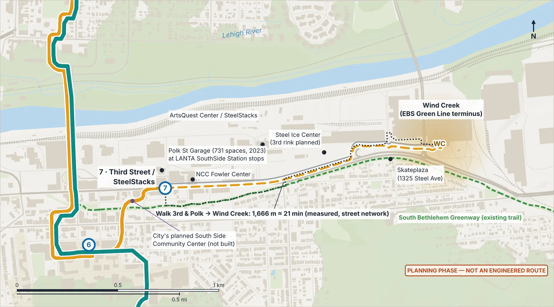
Served first via Third St and the existing EBS Green Line; River Line extension only if demand
- 7Third Street / SteelStacks
- WCWind Creek
Connect Spine (Phase 1)River Line (Phase 1)Dashed: options and if-demand linksGondola optionLANTA EBS todayShaded area: a station area or evaluated destination on Lehigh, hospital, casino or private retail land, not a site
Why here
The measured walk from 3rd & Polk is 1,666 m (~21 min) — too far to count as station access. But Wind Creek is already the EBS Green Line terminus, so no duplicate station is proposed now.
Ideas if pursued (to study)
- Timed River Line ↔ Green Line transfer at Third St
- Greenway lighting and wayfinding
- Shift-change trips tested with Wind Creek
- River Line extension (+1.46 km) only if demand supports it
What exists today
- Existing LANTA EBS Green Line terminus.
 (opens the full-size image)
Measured here
- Lines
- Valley Express — bus option · River Line extension to Wind Creek
- Elevation
- 79 m (USGS 3DEP)
- Future train access
- Sits on the rail-ready valley corridor at Wind Creek.
- Stop option nearby
- South Bethlehem (City parkland): an optional stop on the Valley Express, 2.33 km from here, only if a separately proposed park is built
Still unknown
- Late-night demand and employer pass interest