Independent transportation plan
Bethlehem Connect
Planning phase. An independent plan; nothing is funded or built yet. What this means
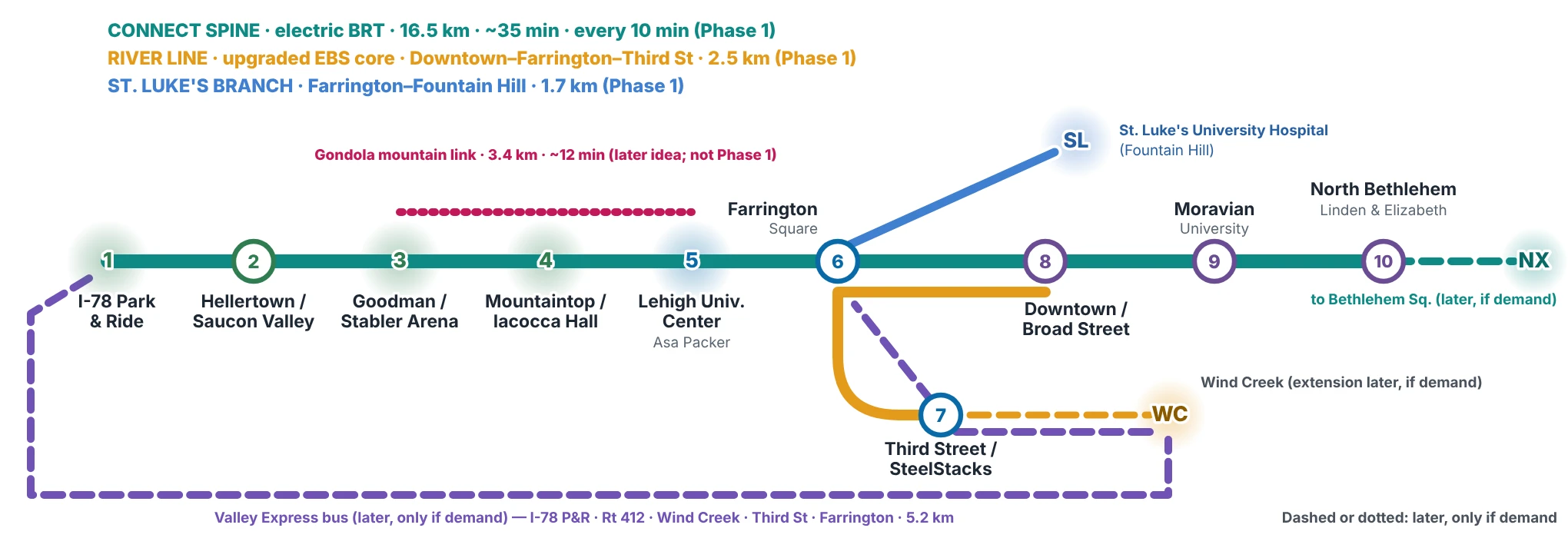
A proposed hybrid, high-frequency electric transit network linking Saucon Valley, Lehigh University's three campuses, the Southside, Downtown Bethlehem, Moravian University and North Bethlehem — built on the bus service that exists today.
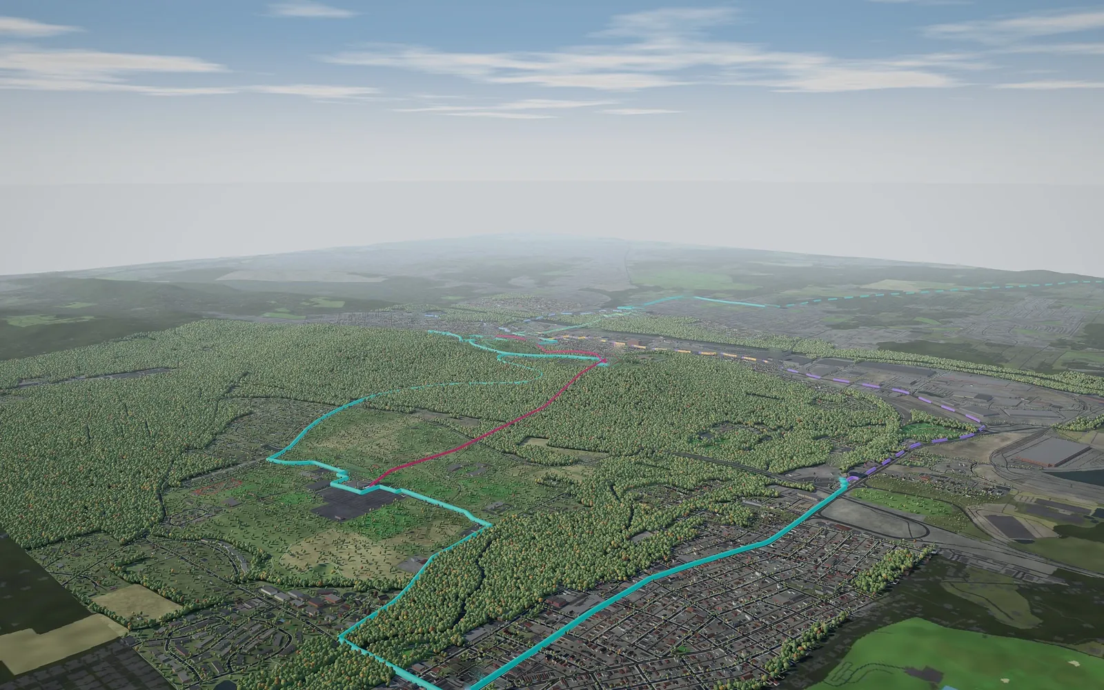 (opens the full-size image)Illustration only — not a design
Each place, on one page
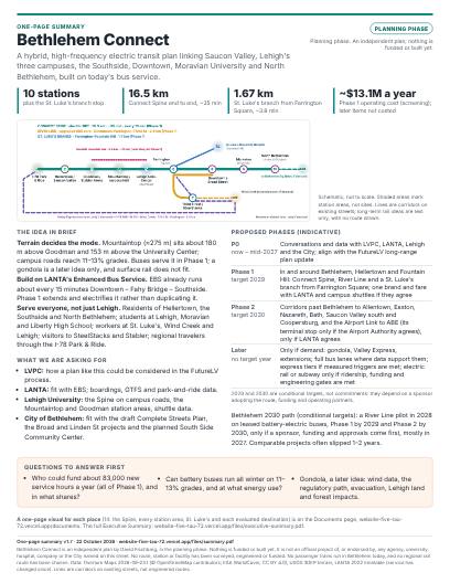 One-page summaryThe plan in brief
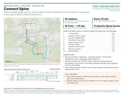 Connect SpinePhase 1 · conditional target 2029
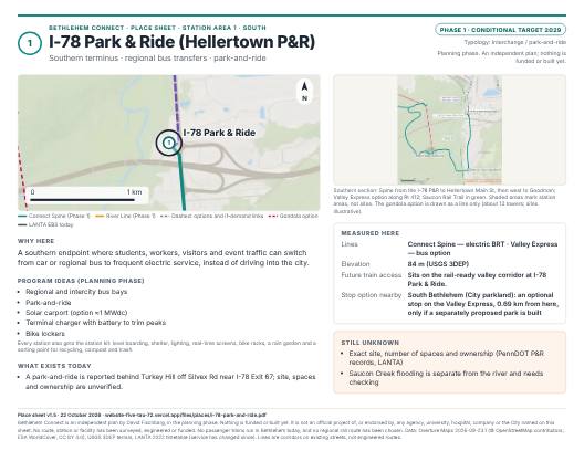 1 · I-78 Park & Ride (Hellertown P&R)Phase 1 · conditional target 2029
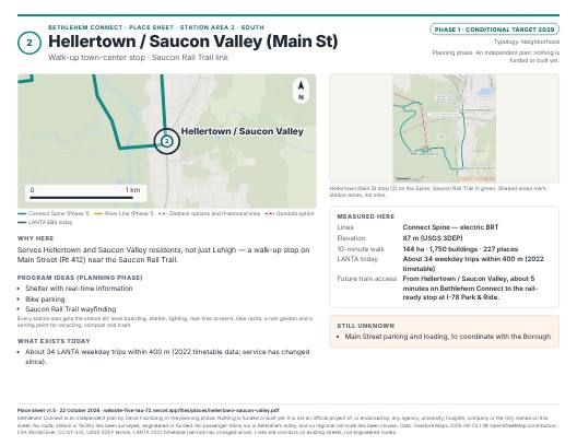 2 · Hellertown / Saucon Valley (Main St)Phase 1 · conditional target 2029
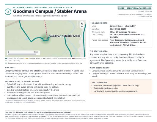 3 · Goodman Campus / Stabler ArenaPhase 1 · conditional target 2029
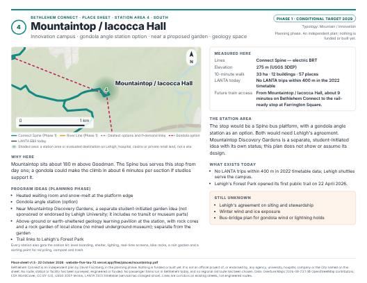 4 · Mountaintop / Iacocca HallPhase 1 · conditional target 2029
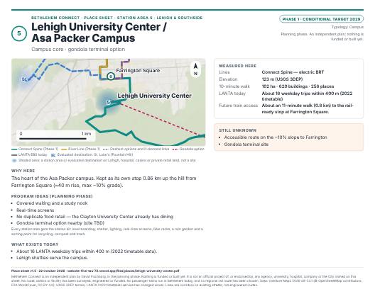 5 · Lehigh University Center / Asa Packer CampusPhase 1 · conditional target 2029
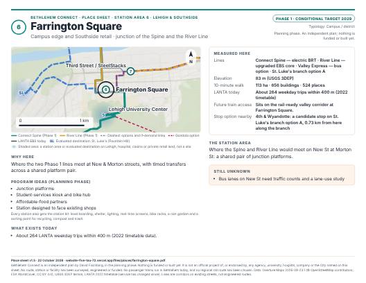 6 · Farrington SquarePhase 1 · conditional target 2029
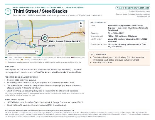 7 · Third Street / SteelStacksPhase 1 · conditional target 2029
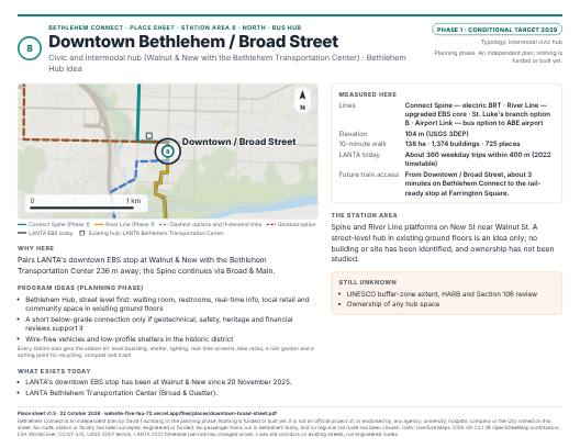 8 · Downtown Bethlehem / Broad Street (bus hub)Phase 1 · conditional target 2029
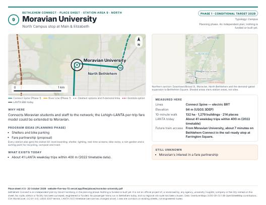 9 · Moravian UniversityPhase 1 · conditional target 2029
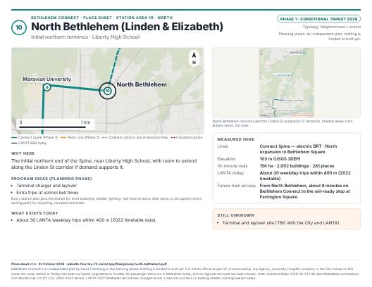 10 · North Bethlehem (Linden & Elizabeth)Phase 1 · conditional target 2029
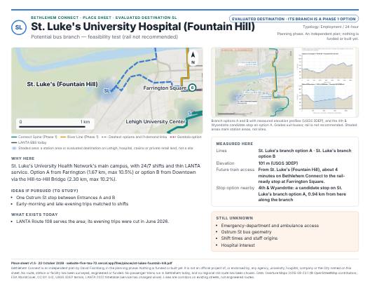 SL · St. Luke's University Hospital (Fountain Hill)Evaluated destination · its branch is a Phase 1 option
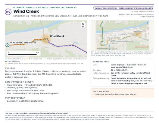 WC · Wind CreekEvaluated destination · extension only if demand (Phase 1)
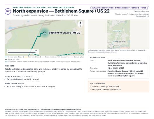 NX · North expansion — Bethlehem Square / US 22Evaluated destination · extension only if demand (Phase 1)
The plan in four numbers
10
proposed station areas, plus 3 evaluated extensions (St. Luke's, Wind Creek, North expansion)
16.5 km
Proposed Connect Spine, I-78 Park & Ride → Linden & Elizabeth; ~35 min in-vehicle (model)
~12 min
gondola possibility Goodman ↔ Asa Packer via Mountaintop / Iacocca Hall (3.4 km), vs ~14 min by bus
$11.2M / yr
screening operating cost for the Phase 1 core lines (Spine and River Line) at LANTA's 2024 bus cost per hour (≈71,000 revenue hours; more in later years; options and extensions not costed) — the binding constraint
What exists, what is proposed, what is long-term
Existing today
LANTA's Enhanced Bus Service already runs a combined bus about every 15 minutes between Downtown, the Fahy Bridge and the Southside, with its downtown stop at Walnut & New since November 2025. Lehigh runs campus shuttles. Trails and railroad tracks exist; there is no passenger rail service in Bethlehem today.
Phase 1 · conditional target 2029
Connect Spine: electric bus rapid transit from the I-78 Park & Ride through Hellertown, Lehigh's Goodman, Mountaintop and Asa Packer campuses, Farrington Square, Downtown and Moravian to Linden & Elizabeth. River Line: an upgrade of the existing EBS core to Third Street / SteelStacks.
Phase 1 optionsPhase 2 · conditional target 2030Long-term idea
Phase 1 options: a gondola for the South Mountain climb, a Valley Express bus on a rail-ready corridor, an Airport Link bus to ABE airport, and extensions if demand supports them. Phase 2 (conditional target 2030): five corridor options past Bethlehem, coordinated with LANTA, which decides. Long-term: valley rail, only behind ridership, funding and engineering gates. Express tiers and expansion across Pennsylvania are a speculative vision.
Explore the plan
- Interactive Network Map →Layers for existing transit, illustrative proposals, the gondola possibility and the Airport Link option; long-term rail ideas as text only.
- Corridors & Stops →The Spine, the River Line, options and all 13 destinations with measured distances and grades.
- Transportation Alternatives →Bus rapid transit, gondola, light rail, tunnel and metro compared fairly, corridor by corridor.
- Bethlehem 2030 →What could open by 2030 if every partner commits in 2027 — and what must be true first.
- Long-Term Vision →Built to expand: express tiers, regional links, easy train access on a rail-ready corridor, and Project OS.
- Proposed Community Stations →Accessible stations, amenities, the Bethlehem Hub, gardens, recreation and a finds museum idea.
- Energy & Sustainability →Grid-backed electric buses, solar, ground-source heating and cooling, storage — counted honestly.
- Work on the Line →The roles the line would need, with a one-screen quick guide and a quest path for each open and trained role. No roles are offered yet.
- Documents & Sources →Download the one-page map, executive summary and long-term supplement; data credits and methods.
- FAQs →What stage is it at? Who pays? Why a gondola? Will it be done by 2030?
- Contact →Send feedback or corrections without creating an account.
Status, October 2026
Guiding idea