Bethlehem Connect · Place sheet · Station area 1 · South
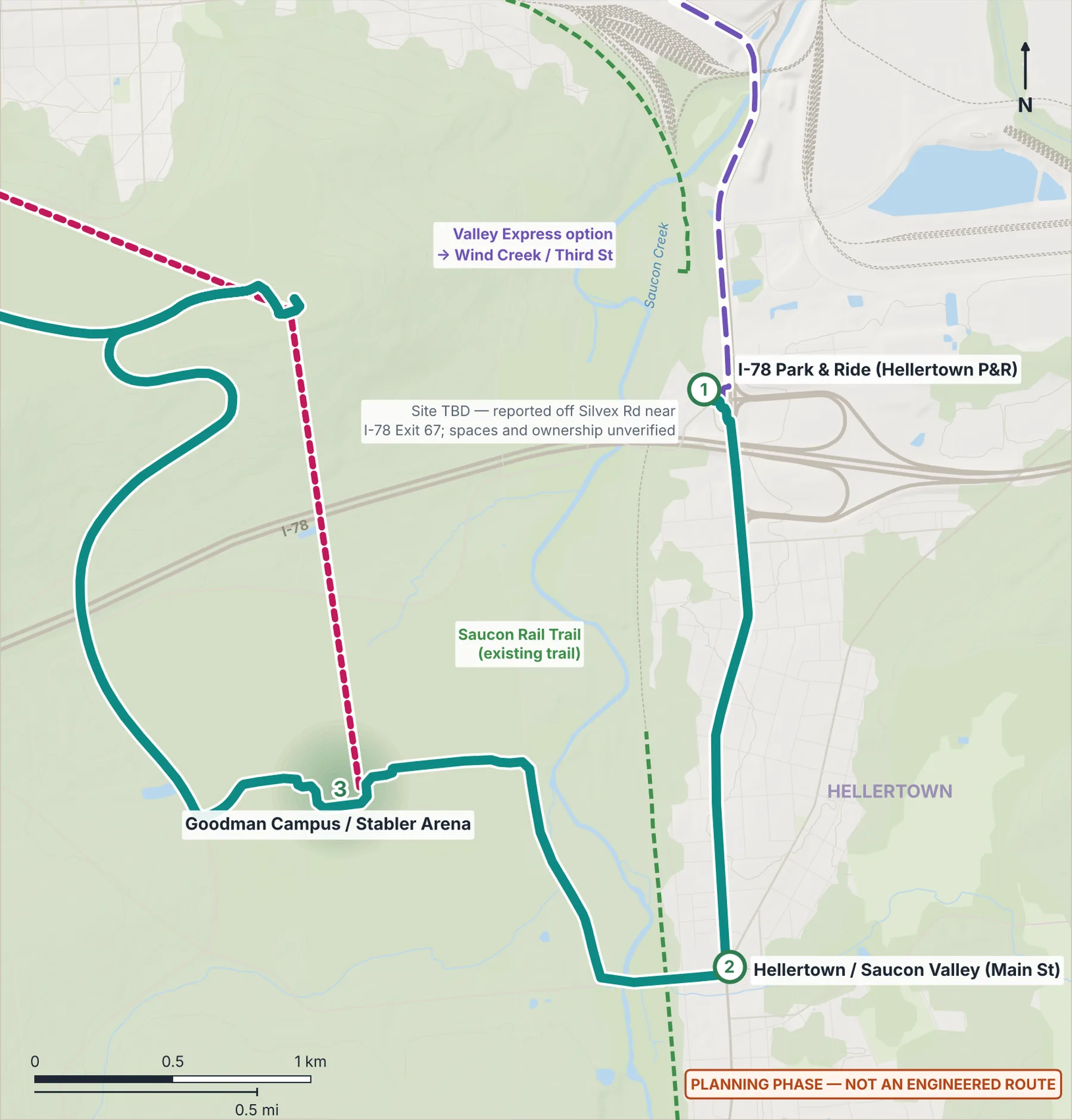
I-78 Park & Ride (Hellertown P&R)
Southern terminus · regional bus transfers · park-and-ride
- 1I-78 Park & Ride
Connect Spine (Phase 1)River Line (Phase 1)Dashed: options and if-demand linksGondola optionLANTA EBS today
Why here
A southern endpoint where students, workers, visitors and event traffic can switch from car or regional bus to frequent electric service, instead of driving into the city.
Program ideas (planning phase)
- Regional and intercity bus bays
- Park-and-ride
- Solar carport (option ≈1 MWdc)
- Terminal charger with battery to trim peaks
- Bike lockers
Every station also gets the station kit: level boarding, shelter, lighting, real-time screens, bike racks, a rain garden and a sorting point for recycling, compost and trash.
What exists today
- A park-and-ride is reported behind Turkey Hill off Silvex Rd near I-78 Exit 67; site, spaces and ownership are unverified.
 (opens the full-size image)
Measured here
- Lines
- Connect Spine — electric BRT · Valley Express — bus option
- Elevation
- 84 m (USGS 3DEP)
- Future train access
- Sits on the rail-ready valley corridor at I-78 Park & Ride.
- Stop option nearby
- South Bethlehem (City parkland): an optional stop on the Valley Express, 0.69 km from here, only if a separately proposed park is built
Still unknown
- Exact site, number of spaces and ownership (PennDOT P&R records, LANTA)
- Saucon Creek flooding is separate from the river and needs checking