Bethlehem Connect · Place sheet · The whole line
Connect Spine
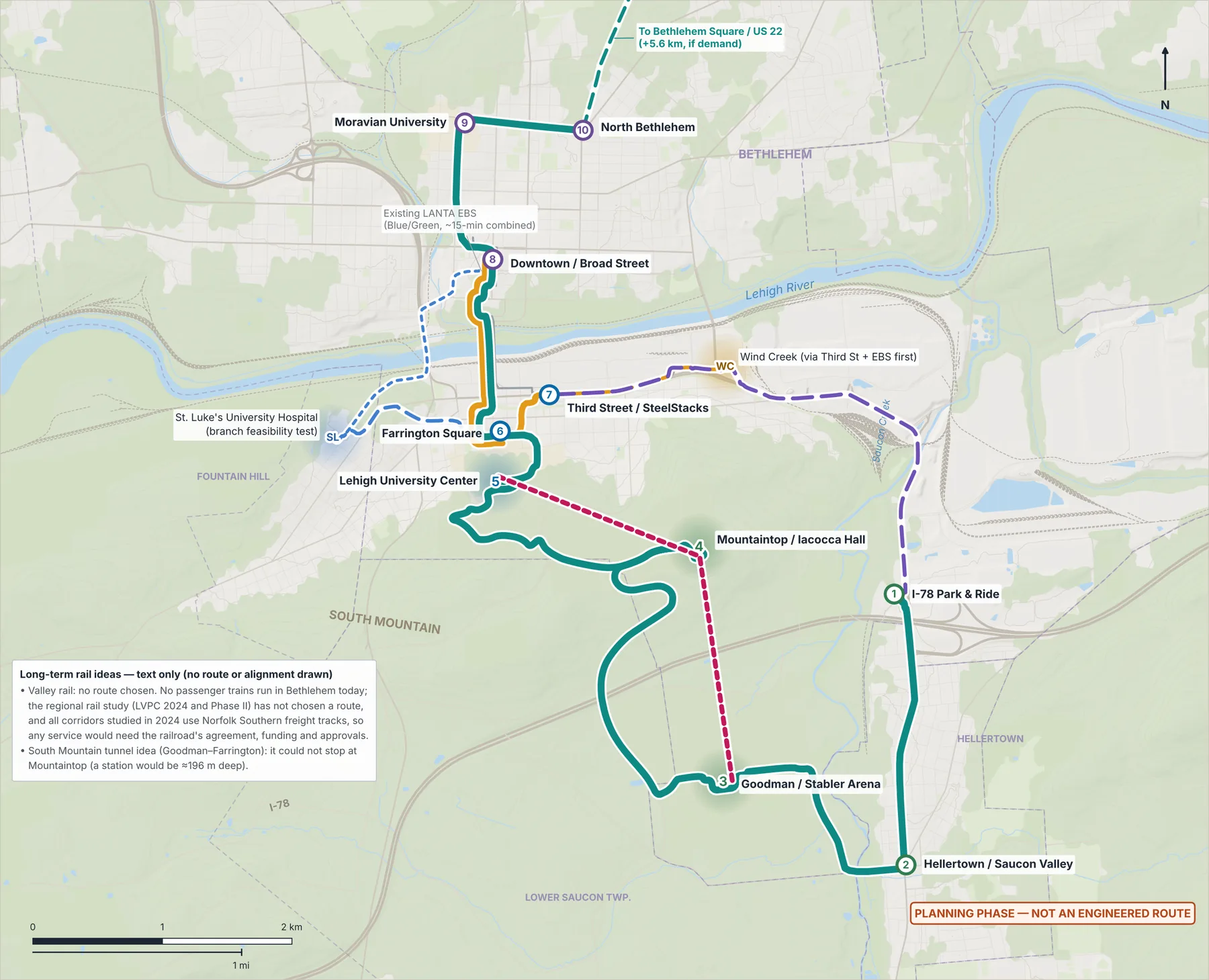
Electric bus rapid transit from the I-78 Park & Ride to Linden & Elizabeth: 16.5 km and about 35 minutes end to end, built on LANTA's Enhanced Bus Service.
 (opens the full-size image)
 (opens the full-size image)
10 stations9 on the Spine, 1 on the River Line; plus 3 evaluated destinations
Every 10 min18 hours a day (planning assumption)
16.5 km · ~35 minend to end, measured on street data
11 electric Spine buses9 at the peak; 15 with the River Line
Spine stations, south to north (minutes from the stop before)
| 1 | I-78 Park & Ride | start |
|---|---|---|
| 2 | Hellertown / Saucon Valley | ~4.7 |
| 3 | Goodman / Stabler Arena | ~4.6 |
| 4 | Mountaintop / Iacocca Hall | ~7.8 |
| 5 | Lehigh University Center | ~6.2 |
| 6 | Farrington Square | ~2.3 |
| 8 | Downtown / Broad Street | ~3.3 |
| 9 | Moravian University | ~3.3 |
| 10 | North Bethlehem | ~2.4 |
Connections
- River Line (Phase 1): Downtown – Farrington Square – Third Street / SteelStacks, 2.5 km, upgrading LANTA's EBS core.
- Gondola mountain link: a Phase 1 option, about 12 minutes Goodman – Mountaintop / Iacocca Hall – Asa Packer, decided only after wind, regulatory, land and cost studies.
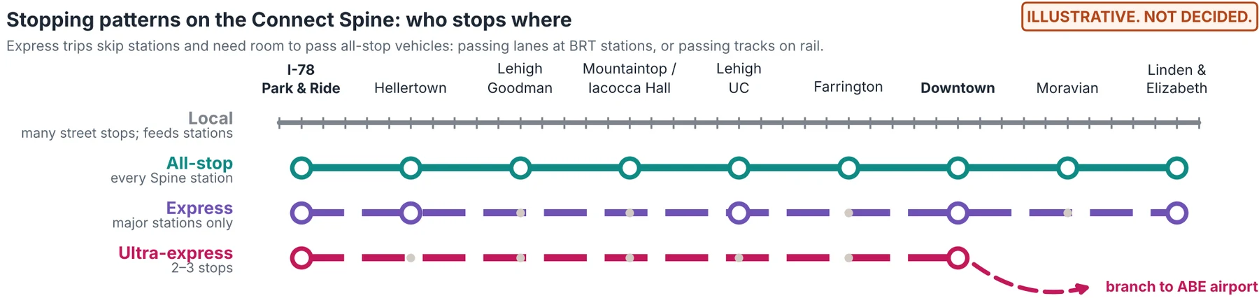
- Service tiers (long-term vision): local, all-stop, express limited-stop and ultra-express hub-to-hub.
Still unknown
- Who could fund about 71,000 new service hours a year (Spine and River Line), and in what shares.
- Whether battery buses can run all winter on 11–13% campus grades, and at what energy use.