Bethlehem Connect · Place sheet · Station area 10 · North
North Bethlehem (Linden & Elizabeth)
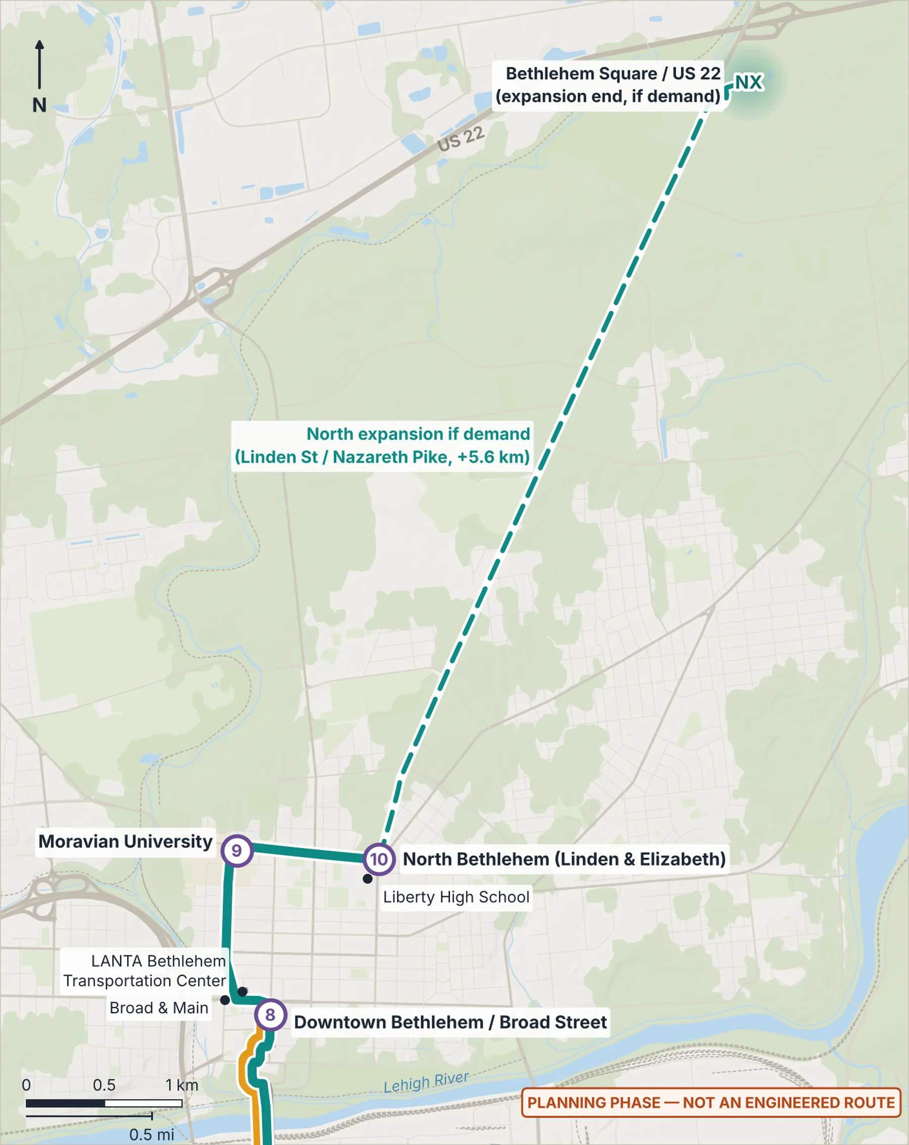
Initial northern terminus · Liberty High School
- 9Moravian University
- 10North Bethlehem
Connect Spine (Phase 1)River Line (Phase 1)Dashed: options and if-demand linksGondola optionLANTA EBS today
Why here
The initial northern end of the Spine, near Liberty High School, with room to extend along the Linden St corridor if demand supports it.
Program ideas (planning phase)
- Terminal charger and layover
- Extra trips at school bell times
Every station also gets the station kit: level boarding, shelter, lighting, real-time screens, bike racks, a rain garden and a sorting point for recycling, compost and trash.
What exists today
- About 30 LANTA weekday trips within 400 m (2022 timetable data).
 (opens the full-size image)
Measured here
- Lines
- Connect Spine — electric BRT · North expansion to Bethlehem Square
- Elevation
- 103 m (USGS 3DEP)
- 10-minute walk
- 156 ha · 2,002 buildings · 281 places
- LANTA today
- About 30 weekday trips within 400 m (2022 timetable)
- Future train access
- From North Bethlehem, about 9 minutes on Bethlehem Connect to the rail-ready stop at Farrington Square.
Still unknown
- Terminal and layover site (TBD with the City and LANTA)