Bethlehem ConnectPlanning phase — home

Bethlehem Connect · Place sheet · Station area 9 · North

Moravian University

North Campus stop at Main & Elizabeth

Phase 1 · conditional target 2029

Typology: Campus

Planning phase. An independent plan; nothing is funded or built yet.

Locator map of Moravian University and the lines around it
  • 9Moravian University
  • 10North Bethlehem

Connect Spine (Phase 1)River Line (Phase 1)Dashed: options and if-demand linksGondola optionLANTA EBS today

Why here

Connects Moravian students and staff to the network; the Lehigh–LANTA per-trip fare model could be extended to Moravian.

Program ideas (planning phase)

  • Shelters and bike parking
  • Fare partnership (proposal)

Every station also gets the station kit: level boarding, shelter, lighting, real-time screens, bike racks, a rain garden and a sorting point for recycling, compost and trash.

What exists today

  • About 41 LANTA weekday trips within 400 m (2022 timetable data).
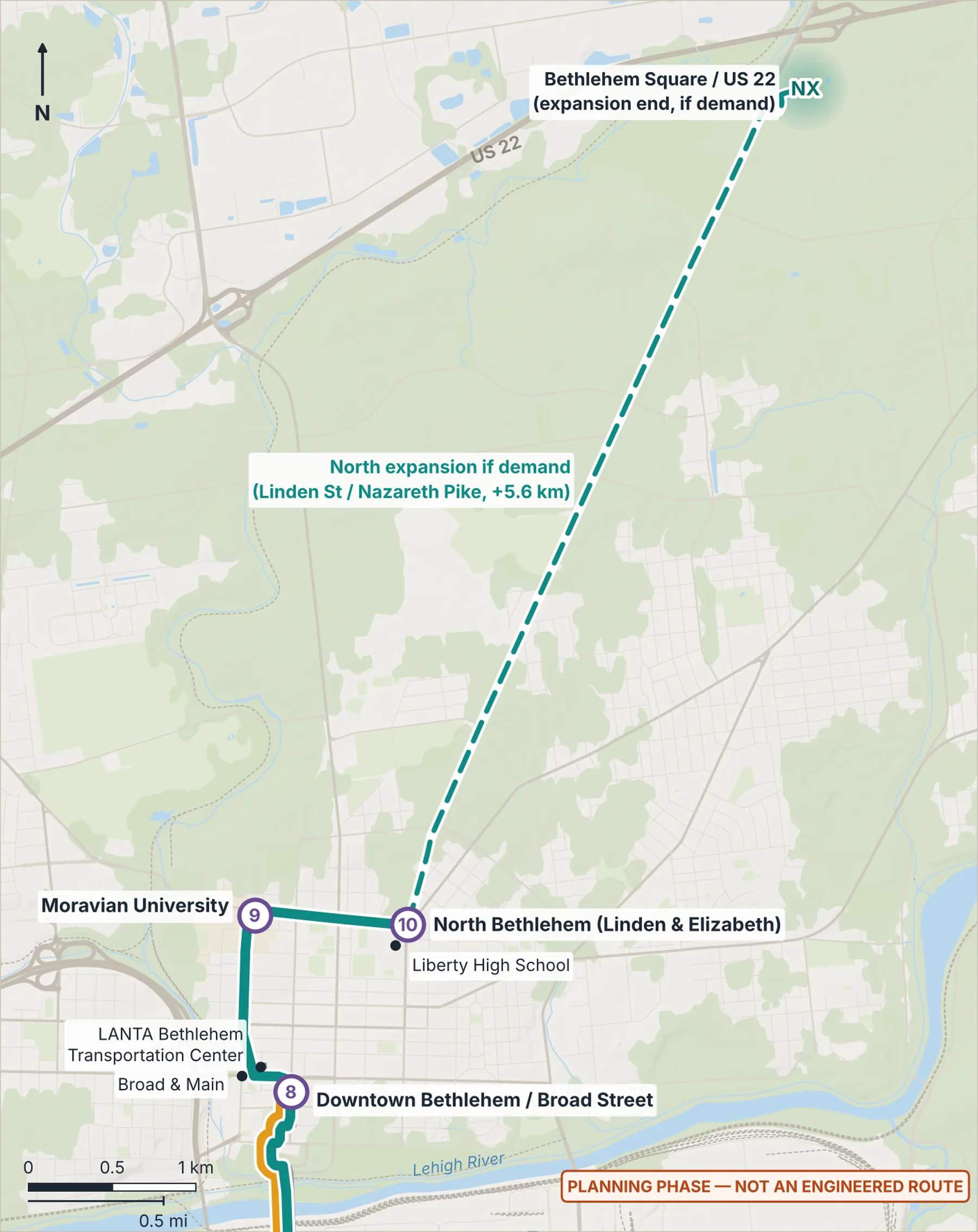
Map of the northern section: Downtown, Moravian and North Bethlehem with the expansion to Bethlehem Square (opens the full-size image)
Northern section: Downtown/Broad St, Moravian, North Bethlehem and the demand-gated expansion to Bethlehem Square. Shaded areas mark station areas, not sites.

Measured here

Lines
Connect Spine — electric BRT
Elevation
94 m (USGS 3DEP)
10-minute walk
132 ha · 1,279 buildings · 214 places
LANTA today
About 41 weekday trips within 400 m (2022 timetable)
Future train access
From Moravian University, about 7 minutes on Bethlehem Connect to the rail-ready stop at Farrington Square.

Still unknown

  • Moravian's interest in a fare partnership

Place sheet v1.5 · 22 October 2026 · website-five-tau-72.vercel.app/files/places/moravian-university.pdf

Bethlehem Connect is an independent plan by David Fischbarg, in the planning phase. Nothing is funded or built yet. It is not an official project of, or endorsed by, any agency, university, hospital, company or the City named on this sheet. No route, station or facility has been surveyed, engineered or funded. No passenger trains run in Bethlehem today, and no regional rail route has been chosen. Data: Overture Maps 2026-09-23.1 (© OpenStreetMap contributors; ESA WorldCover, CC BY 4.0), USGS 3DEP terrain, LANTA 2022 timetable (service has changed since). Lines are corridors on existing streets, not engineered routes.