Station area 9 · North
Moravian University
Planning phase. An independent plan; nothing is funded or built yet. What this means
Why here
Connects Moravian students and staff to the network; the Lehigh–LANTA per-trip fare model could be extended to Moravian.
Program ideas Proposed · planning phase
- Shelters and bike parking
- Fare partnership (proposal)
Which extras are worth it here, maybe later, or not worth it is rated further down this page.
What exists today Existing today
- About 41 LANTA weekday trips within 400 m (2022 timetable data).
Measured station area
- Elevation
- 94 m (USGS 3DEP)
- 10-minute walk
- 132 ha · 1,279 buildings · 214 places
Walk areas are slope-adjusted 10-minute walksheds on the Overture pedestrian network; building and place counts are intensity proxies, not population or jobs.
Future train access One Connect ride to a rail-ready stop
From Moravian University, about 7 minutes on Bethlehem Connect to the rail-ready stop at Farrington Square.
No passenger trains run in Bethlehem today, and no regional rail route or station has been chosen. Rail-ready stops are where this plan would keep space free. How this was measured.
Measured links
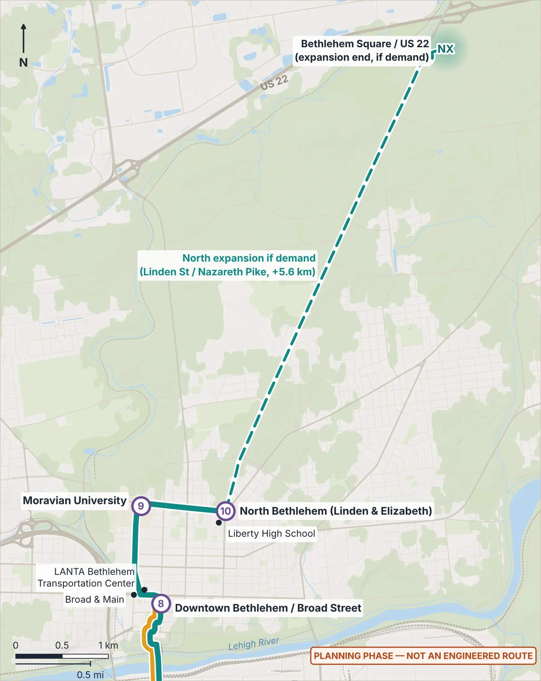
- Connect Spine — electric BRT: Downtown / Broad Street → Moravian University · 1.43 km · ~3.3 min · max 8.4%
- Connect Spine — electric BRT: Moravian University → North Bethlehem · 0.92 km · ~2.4 min · max 5.7%
Still unknown
- Moravian's interest in a fare partnership
Amenities here: worth it or not Screening judgment
Campus through stop on Main St with light use today (214 places, 41 trips), where the standard kit plus a proposed fare partnership covers most needs and the main open question is a possible LVH–Muhlenberg bus-branch idea.
Worth it here
- Solar panels on the station canopy: The standard canopy gets solar under the energy plan; shading and an account to take the credits are to confirm.
Maybe later here
- Secure bike lockers or bike hub, and bike-share docks: Not a terminus, junction or trail stop, so racks first. E-bike share only if an operator commits; lockers only if racks fill.
- Equipment-lending lockers or package lockers: 1,279 buildings meets the package-locker test, but only with room off the walking path and a vendor installing them free.
- Public art and heritage or geology display: Hardyston quartzite appears in Moravian buildings, but a display needs sourced content and Moravian's interest (to confirm).
- Hospital and 24/7 shift-worker features: LVH–Muhlenberg is a 3,412 m walk away; shift-timed transfers apply only if a Muhlenberg branch idea from here is added.
Not worth it here
- Heated, enclosed waiting room: Through stop with 10-minute service (about a 5-minute wait); a wind-screened shelter, optionally with an on-demand heater, is enough.
- Public restrooms: Low use (41 trips) and no long transfer waits at this through stop.
- Staffed customer service: Light use (41 trips), so the help point and real-time screens are enough.
- Park-and-ride: Walkable campus area (1,279 buildings, 214 places) far from any highway interchange.
- Drop-off and paratransit loading zone: The Main St curb is needed for the platform; use legal loading on a side street within ~50 m.
- Terminal bus charger (overhead pantograph): Through stop with a 20-25 s dwell; buses would charge at the proposed NBETH terminal, 0.92 km on (site TBD).
- Battery energy storage: Open-air stop with only lights, screens and a help point; a small UPS covers communications.
- Food or coffee kiosk (partner-run): Below the footfall test (214 places, 41 trips), and it would compete with Main St businesses; point riders to them.
- Small shop space: Too few people pass (214 places, 41 trips) to support a tenant.
- Community lounge or study nook: Open-air stop with no host; revisit only if Moravian proposes one.
- Water bottle filler: An open-air through stop would need a new water line and freeze protection, with no trail, event or long-wait need.
- Event queuing and bus staging space: No 5,000-seat venue or major festival site is identified near this stop.
- Elevators (in pairs), only at level changes: Curbside platform with no level change; ramps handle the rise.
- Ground-source heat pumps (enclosed spaces only): Open-air shelter with nothing enclosed to heat.
- Snow-melt at the platform edge: Valley stop at 94.3 m; the 8.4% grade is on the bus route, not a measured walk. Revisit above ~8%.
- Driver restroom and break room: A through stop; drivers would take breaks at the proposed NBETH layover, 0.92 km on.
- Regional and intercity bus bays: No regional or intercity carrier stops here; those connections are at the Downtown BTC.
- Rail-ready space reservation: Not on the protected rail-ready corridor; FARR is 2,670 m away.
- Energy display with real solar and charging data: Open-air stop with no charger and no host; the screen is needed for arrival times.
- Public Wi-Fi and phone charging: Open-air through stop with about 5-minute waits; real-time screens already meet the need.
Every stop also gets the essentials. Ratings are the author's screening judgment from measured data, not a design or a commitment.